
 Asset Publisher
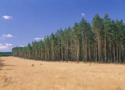
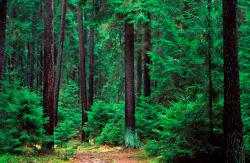
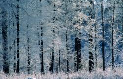
Polish forests
 fot. Paweł Fabijański
 fot. Paweł Fabijański
 fot. Paweł Fabijański
Poland is in the European lead, while concerning the area of all forests. They cover about 29,2 % of the country territory, and grow within the area of 9,1 million hectares. The overwhelming majority of the forests is state owned, of which almost 7,6 million hectares are managed by the State Forests National Forest Holding..
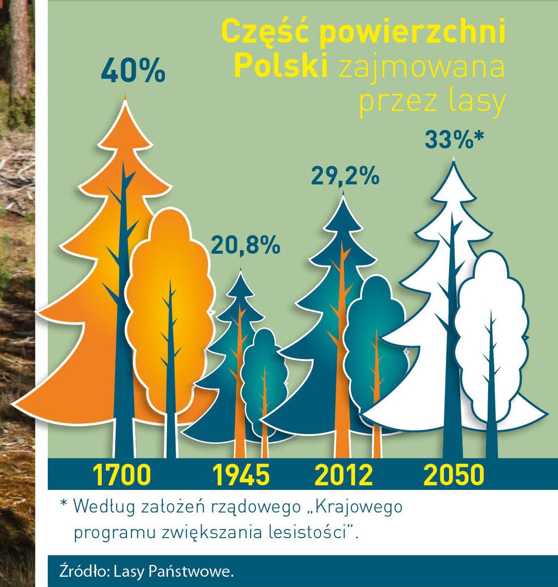
The number of Polish forest is still growing. The forestation rate of the country has increased from 21 % in 1945 to 29,2 % at the moment. Between 1995 and 2008, the forest area increased by 310 thousand ha. The basis for afforestation works is the "National Programme for Increasing the Forest Cover" (KPZL), assuming an increase of the forestation rate up to 30 % by 2020 and up to 33 % by 2050. Polish forests abound in flora, fauna and fungi. 65 % of the total number of animal species live there.
The forests grow in our country on poor soils, mainly because of the development of the agriculture in previous years. It influences the distribution of the types of the forest sites in Poland. Over 55 % of the forest areas is covered with coniferous forests. In other areas, there are forest sites, mainly the mixed ones. Their small part constitute alder and riparian forests – not more than 3 %.
In the years 1945 – 2011 the area of natural deciduous tree stands within the area of the State Forests National Forest Holding increased from 13 to 28,2 %.
Within the lowlands and uplands the most often occurring tee species is pine. It covers 64,3 % of the forest area of the State Forests National Forest Holding and 57,7 % of private and commune forests. In the mountains the predominant species is European spruce ( in the west) and European spruce with beech (in the east). Domination of pine is the result of carrying on sustainable forest management in the past. Once, the monocultures (crops or cultivations of one species) were the answer to the great demand of industry for wood. Such forests appeared to be quite fragile to climatic factors. They also were often the prey of pests' expansion.
In Polish forests, the share of other tree species, especially deciduous trees have been systematically increasing. The foresters have stepped aside from monocultures – that is why, they try to fit specific species of the forest stand to the natural stand, that would be proper for the given area. Thanks to that, in the years 1945 – 2011, the area of the deciduous tree stands within the lands of the State Forests National Forest Holding increased from 13 to 28,2 %. There occur more and more frequently the following tree species: oaks, ashes, maples, sycamore maples, elms, but also birches, beeches, alders, poplars, hornbeams, aspens, tilias and willows.
Our forests are the most often represented by the forest stands aged 40 to 80 years. The average age of the forest equals 60 years. More and more trees are of big size at the age over 80 years. Since the end of the Second World War, the forests' area has increased up to almost 1,85 million hectares.
Raport o stanie lasów w Polsce 2012
Asset Publisher


Asset Publisher
Położenie Nadleśnictwa Jeleśnia
Położenie Nadleśnictwa Jeleśnia

POŁOŻENIE ADMINISTRACYJNE
Nadleśnictwo Jeleśnia administracyjnie położone jest w południowej części województwa śląskiego, na terenie powiatów: żywieckiego i bielskiego. Niewielka część Nadleśnictwa należy do powiatu suskiego (gm. Stryszawa).
Nadleśnictwo Jeleśnia dzieli się na dwa obręby: Jeleśnia (6049 ha) i Żywiec (5635 ha), których łączna powierzchnia wynosi: 11 694 ha
WARUNKI PRZYRODNICZE
Obszar Nadleśnictwa Jeleśnia według regionalizacji przyrodniczo-leśnej położony jest w VIII Karpackiej Krainie Przyrodniczo-leśnej.
OBRĘB JELEŚNIA
Dzielnica 4 Beskidu Żywieckiego
Obejmuje cały obszar obrębu Jeleśnia oraz południową część obrębu Żywiec. Teren jej zbudowany jest głównie z utworów serii magurskiej (trzeciorzędowych piaskowców, łupków i margli). Dzielnica obejmuje nie tylko Beskid Żywiecki; na jej północnym-zachodzie znajduje się również zachodnia część Beskidu Makowskiego (maksymalna wysokość 871 m n.p.m.) (wg Kondracki, „Geografia regionalna Polski", 1998, PWN), . Beskid Żywiecki stanowi najwyżej wzniesioną część Beskidów, cechuje go tzw. młoda rzeźba (np. głębokie rozcięcia przez doliny i duży spadek koryt rzecznych). Składa się on z kilku członów, różniących się wysokością i charakterem rzeźby, wydzielonych przez poprzeczne obniżenia. Obejmuje on najwyższą w Zewnętrznych Karpatach Zachodnich grupę górską Babiej Góry (1725 m n.p.m.), utworzoną ze zwartych pasm górskich. Na południowym-zachodzie znajduje się rozcięta przez dopływ górnej Soły grupa Wielkiej Raczy (1234 m n.p.m.), o układzie gwiaździstym. Między wymienionymi jednostkami położona jest w kształcie rozrogu grupa Pilska (1557 m n.p.m.).Do najwyższych wzniesień z obszaru Beskidu Żywieckiego, leżących w zasięgu Nadleśnictwa należą: Góra Pięć Kopców-1534 m n.p.m., Romanka-1366, Trzy Kopce-1216, Palenica-1343, Munczolik-1356, Majcherkowa-1255, Kotarnica-1156, Buczynka-1205, Mędralowa-1169, Jałowiec-1111, Bąków-766, Kiczora-761 oraz Grojec-612.
OBRĘB ŻYWIEC
Dzielnica 1 Beskidu Śląskiego i Małego
Dzielnica 4 Beskidu Żywieckiego
Na terenie tej dzielnicy położona jest zasadnicza część obrębu Żywiec, w części wschodniej obejmującej teren Beskidu Małego. Stanowi ona najbardziej wysuniętą na północny zachód jednostkę Krainy Karpackiej. Obejmuje ona pasma zbudowane głównie z piaskowców godulskich i istebniańskich, rozdzielone stosunkowo dużą kotliną wypreparowaną w mniej odpornych utworach fliszu. Położony na zachodzie Beskid Śląski tworzy jedną z najbardziej zwartych grup górskich Karpat fliszowych. Charakteryzuje się on wąskimi grzbietami górskimi o zbliżonej wysokości, między którymi znajdują się głębokie (do 600 m) doliny o wąskich dnach i stromych zboczach. Najwyższy szczyt w paśmie Baraniej Góry to Skrzyczne – 1257 m n.p.m., a w paśmie Czantorii – Wielka Czantoria – 995 m n.p.m. Pasmo Baraniej Góry oraz pasmo Czantorii i Stożka stanowią europejski dział wodny między zlewiskami Morza Czarnego i Bałtyckiego.
Znajdująca się na zachód od Beskidu Śląskiego Kotlina Żywiecka otoczona jest ze wszystkich stron pasmami górskimi, które wznoszą się około 500-900 m ponad jej płaskie dno. We wschodniej części dzielnicy położony jest natomiast niższy niż Beskid Śląski i płycej rozcięty przez doliny – Beskid Mały. Największe jego wzniesienia przekraczają 900 m n.p.m. (Czupiel 934 m n.p.m.), a wysokości względne dochodzą do 500 m.
Do najwyższych wzniesień z obszaru Beskidu Małego, leżących w zasięgu Nadleśnictwa należą: Czupiel-934 m n.p.m., Jaworzyna-864, Żar-761, Madohora (Łamana Skała)-929, Potrójna-888, Kocierz-879, Gibasów Groń-898.
|
|
|
|
|
|